LIBYA
SAHARA LAKES & acacus mountains
Duration
15 Days
AREA
Central Sahara
TERRAIN
ROUGH 4X4
LEVEL
***
PAX
MIN3 / MAX6
24°41′02″ N 10°38′03″ E
Avazagar arch · acacus
SECTOR SAHARA-02
briefing
THE OBJECTIVE
Fifteen days off the marked routes. We move deep across the Sahara of Libya, far from any conventional itinerary, exploring some of the most remote and arid mountain ranges on the continent. Our journey takes us through the dramatic canyons of the Acacus mountains, home to world-renowned prehistoric rock art, before venturing into the stone labyrinth of Meghedet. We also step back in time at Germa, the ancient capital of the Garamantes, tracing millennia of civilization hidden in the sand. A journey defined entirely by boundless terrain, absolute silence, and ever-changing landscapes, navigated by an expert expedition team. Designed for those who prefer to travel light and push the boundaries of exploration.
SAFETY & RISK OVERVIEW
Exploration of the Libyan desert takes place in a unique and evolving environment.
Although local conditions have enjoyed relative stability, Libya’s overall security landscape carries inherent risks and requires careful navigation. Our operations rely on comprehensive risk assessments, trusted local connections, and continuous monitoring of ground dynamics.
By adhering strictly to approved routes, local regulations, and the guidance of our local escort team, we minimize risks while delivering an authentic and unforgettable Saharan journey.
LOCATION
EXPEDITION DOSSIER
DOSSIER N° 02 — REMOTE
LIBYA: SAHARA LAKES & REMOTE VOLCANOES
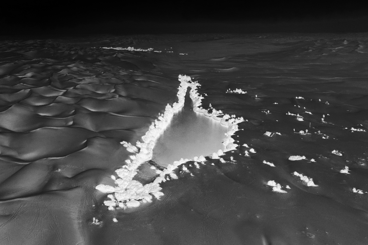
UBARI LAKES
26°48’20” N 13°32’23” E
ITINERARY
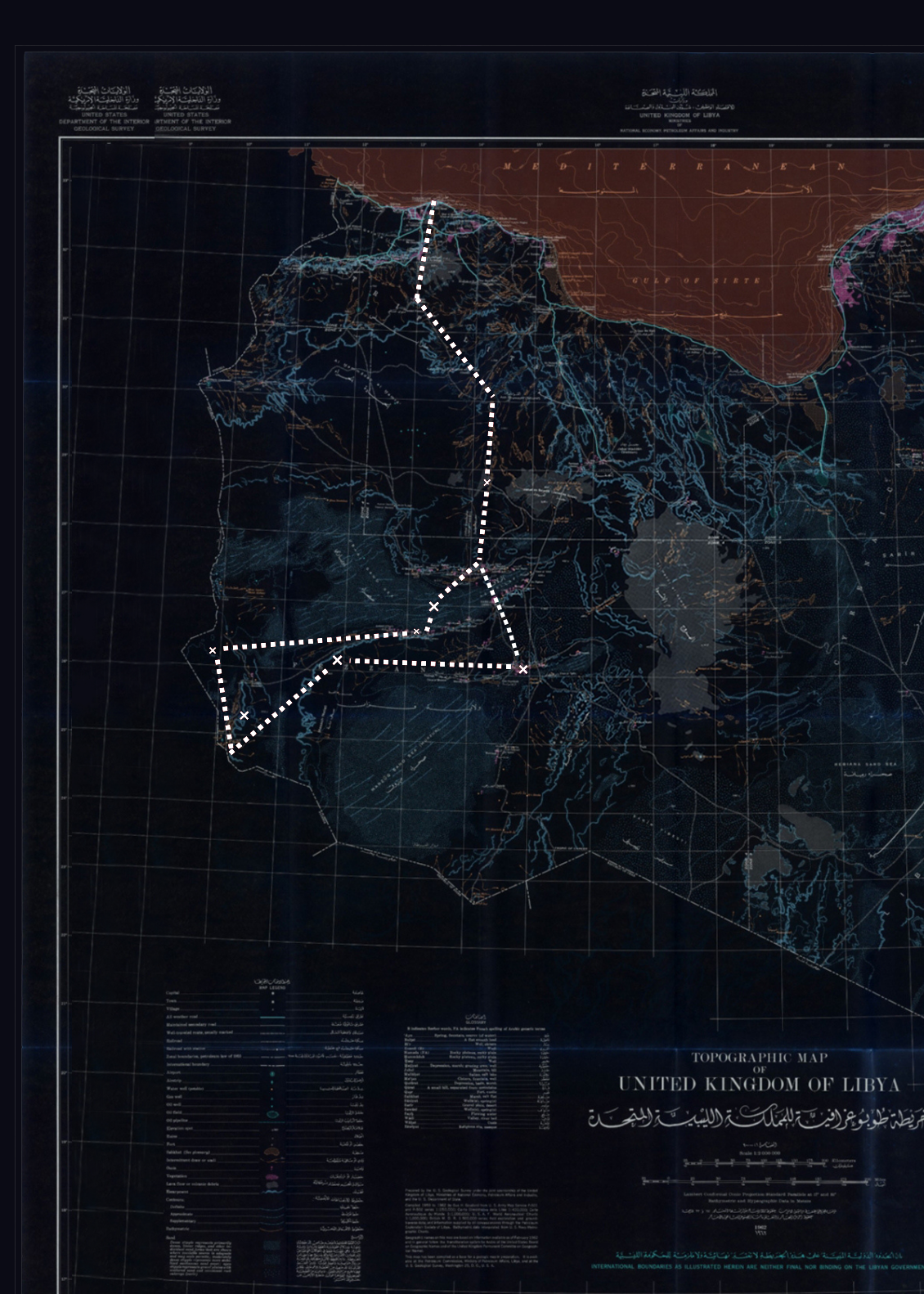
FIVE PHASES
/
Days 1-3
ARRIVAL – INGRESS
Arrival, logistics check, transition from the coastal capital Tripoli into Jabal al Gharbi, cross the first stretch of barren flat desert.
/
Days 4-6
MURZUQ CROSSING – MATKHENDUSH – ACACUS MOUNTAINS
Cross the Murzuq Region, visit Wadi Matkhendush. Enter the Acacus Mountains, discover its hidden cave paintings and engravings, crossing Wan Caza dunes.
/
Days 7-9
GHAT – Meghedet
Drive along the Algerian border, visit Ghat and Meghedet.
/
Days 10-11
CAPITAL OF GARAMANTES – UBARI LAKES
Visit the ancient Garamantes capital, enter the Ubari sand dunes and visit its emblematic lakes.
/
Days 12-15
EXIT – DEPARTURE
Retrace the route out from the sand sea, last two bivouac, entering the capital. Departure.
LOCATION
EXPEDITION DOSSIER
DOSSIER N° 02 — REMOTE
SAHARA LAKES & acacus mountains
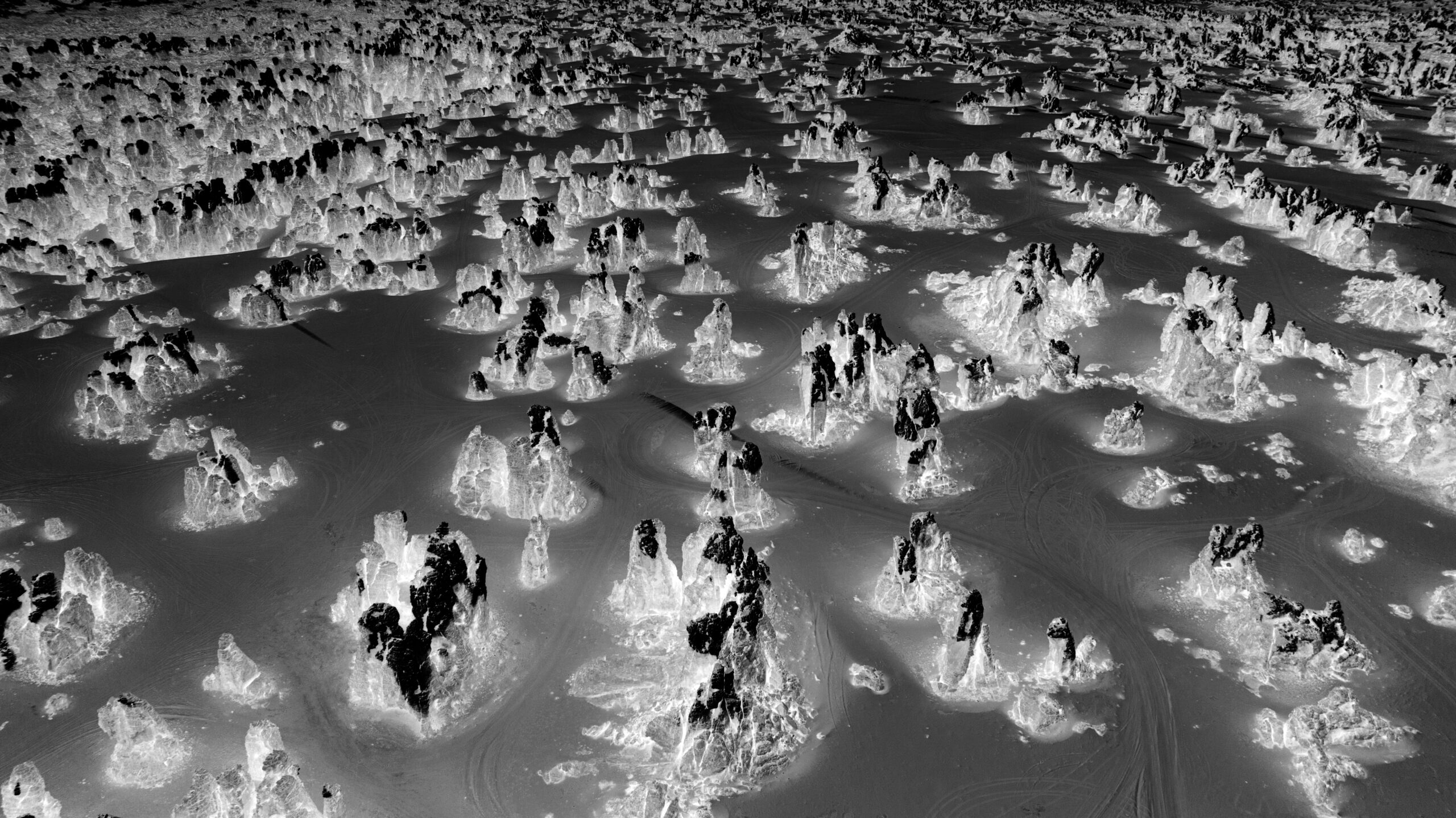
Meghedet
26°03′25″ N 9°56′45″ E
LOGISTICS
FIELD SETUP
/A
VEHICLES
4x4s equipped for long-range crossings, full mechanical redundancy, back-up fuel tanks.
/B
GUIDES
Led by Giulio and the local team with extended, ground-level knowledge of the terrain and the region.
/C
COMMS
Satellite coverage, Satellite communicative safety protocols across the entire route.
/D
CAMP
Comfortable mobile bivouac, shower system, water and power self-sufficiency for the full crossing.
FLEXIBILITY
Traveling in Libya involves intricate and ever-changing logistical challenges. Consequently, our itinerary may be subject to drastic modifications and ongoing reassessment if required. A flexible mindset is essential for all participants. Unexpected changes to routes, timings, and stops can occur as an integral part of this expedition, and adaptability is key to a safe and successful journey.
LOCATION
EXPEDITION DOSSIER
DOSSIER N° 02 — REMOTE
SAHARA LAKES & acacus mountains
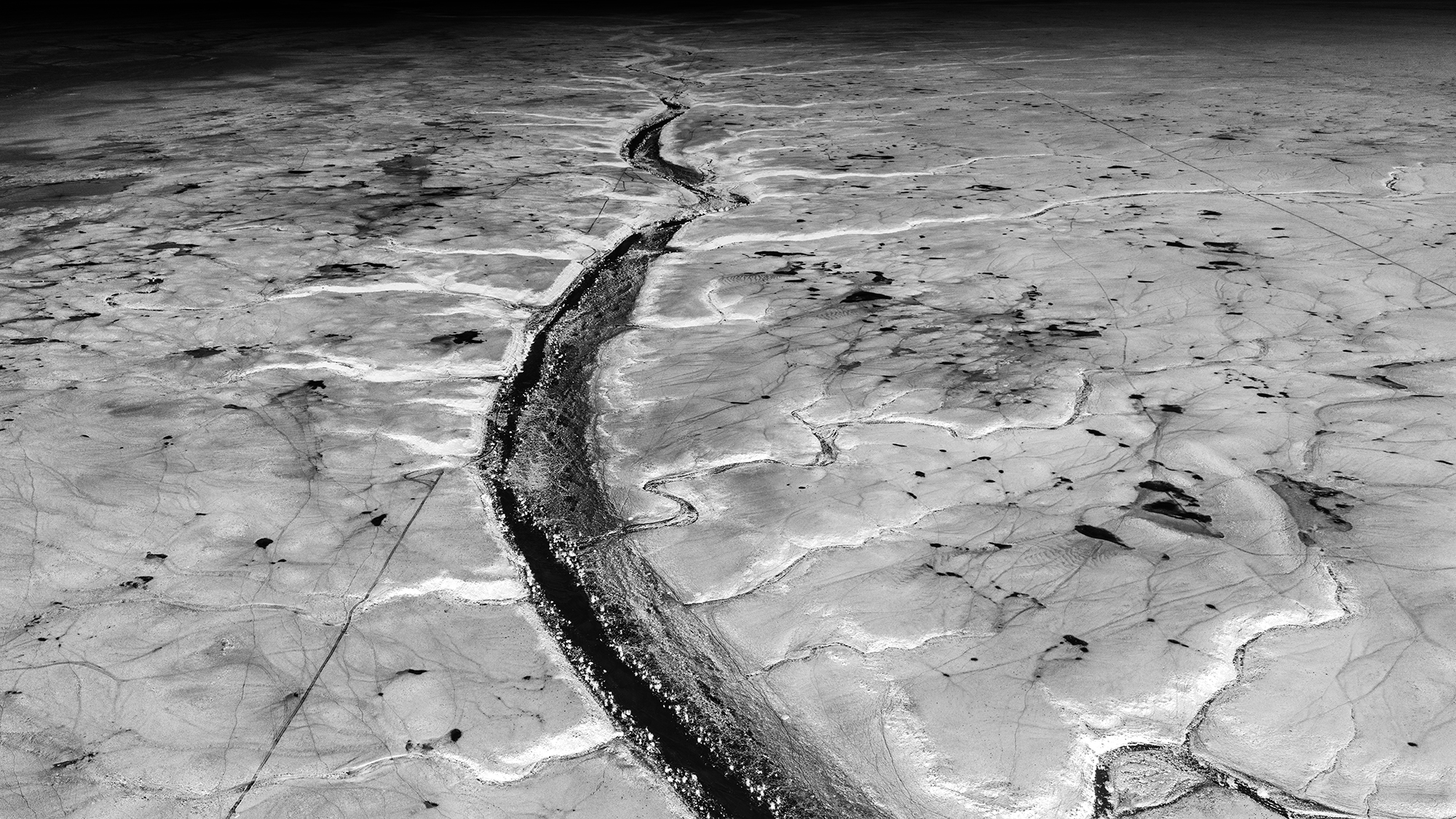
WADI MATKHENDUSH
25°45′47″ N 12°10′12″ E
logistics
EXPEDITION INSIGHTS
/INCLUSIONS
▸ Airport welcoming and assistance
▸ Airport transfer upon arrival and departure
▸ Airport taxes and fees
▸ Hotel and accommodations
▸ 4×4 equipped vehicles in convoy and fuel
▸ Camping equip. (tent, sleeping bag, mattress and pillow)
▸ Military and regional permits and fees
▸ Tourism Police fees
▸ 3 meals x day and snacks
▸ Cook and cooking equipment
▸ Water and drinks for the whole expedition
▸ Archaeological sites entry fees
/EXCLUSIONS
▸ International flights
▸ Visa
▸ Health/Travel Insurance
▸ Personal Spendings
▸ Whatever not mentioned as included
Duration
15 DAYS/14 NIGHTS
PAX
MIN3/MAX6
€ PP
5,680 € (3/4 pax)
5,210 € (5+ pax)
$ PP
$6,500 (3/4 pax)
$6,050 (5+ pax)
TOPOGRAPHY
EXPEDITION DOSSIER
DOSSIER N° 02 — REMOTE
LIBYA: REMOTE VOLCANOES & FULL SAHARA
itinerary
LIBYA: SAHARA LAKES & acacus mountains
HIGHLIGHTS
HIGHLIGHTS
DOSSIER N° 02 — REMOTE
LIBYA: SAHARA LAKES & acacus mountains
MEGHEDET
25°52’17″N 13°57’58″E
/yardang field
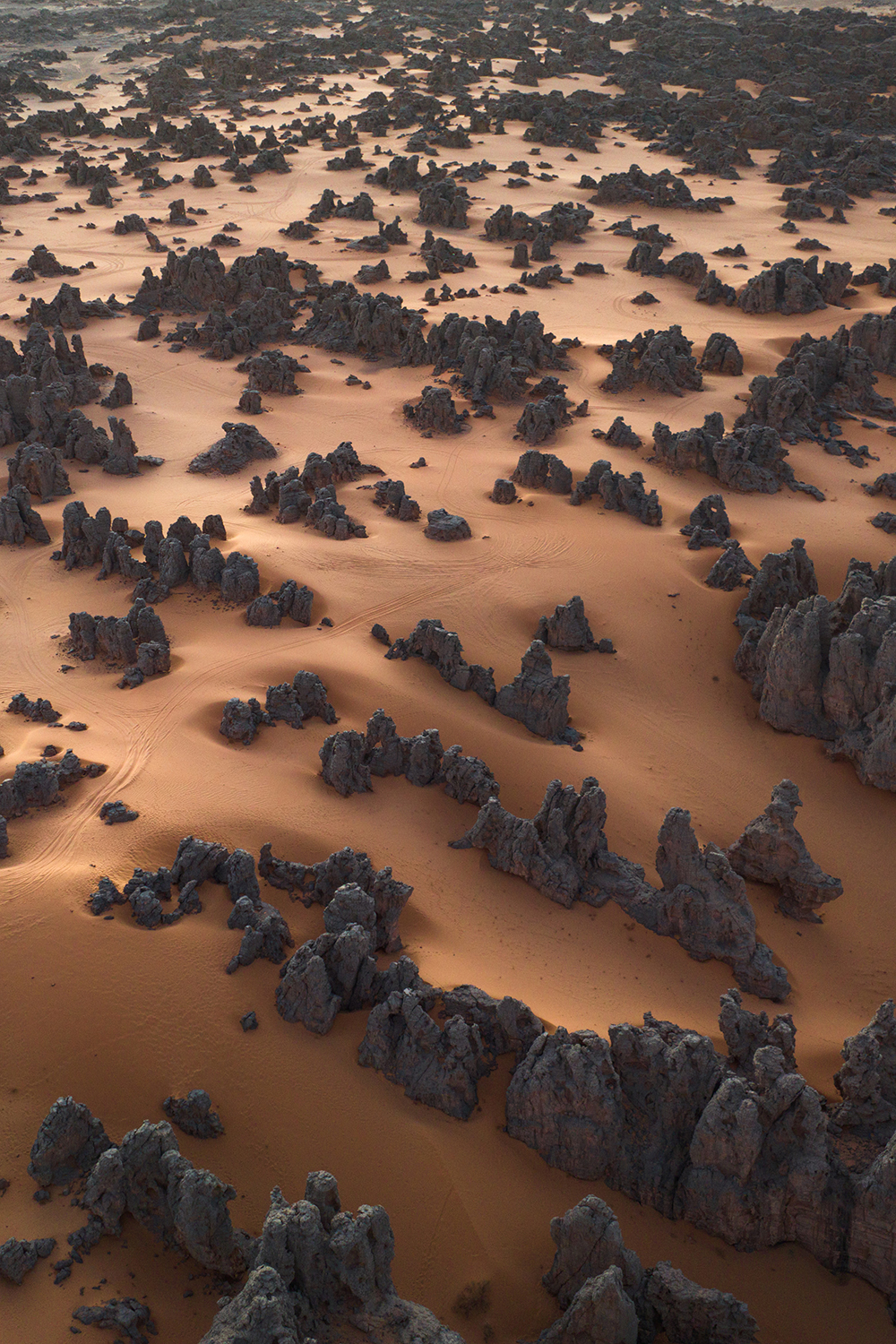
Hidden amidst the towering, rust-colored sand dunes of the Fezzan desert in southwestern Libya, Meghedet, a remote and breathtaking stone landscape, forms a surreal geological wonder. Surrounded by sweeping sands and vast open horizons, its towering sandstone monoliths and labyrinthine corridors shimmer like ancient architectural ruins against the harsh yellow and red desert backdrop. Historically, these desolate and wind-sculpted areas bordered ancient trans-Saharan routes traveled by nomadic communities. Today, despite their extreme remoteness and the challenging environment, these silent rock formations remain remarkably preserved, contrasting sharply with the scorching surrounding desert temperatures.
DOSSIER N° 02 — REMOTE
LIBYA: SAHARA LAKES & acacus mountains
ACACUS MOUNTAINS
24°55’35″ N 10°35’15″ E
/MOUNTAINS
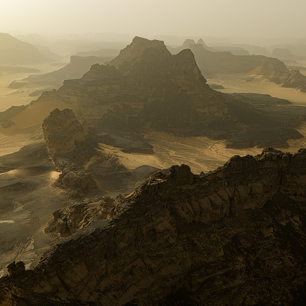
Rising dramatically from the southwestern corner of Libya, the Tadrart Acacus range is a breathtaking labyrinth of sandstone arches, deep gorges, and towering wind-carved rock formations. This UNESCO World Heritage site acts as an open-air museum preserving one of the world’s most significant collections of prehistoric rock art. Dating back thousands of years, the petroglyphs and paintings vividly depict a time when the Sahara was a lush, green savannah teeming with wildlife like giraffes, elephants, and crocodiles, alongside scenes of ancient human life and cattle herding. Furthermore, the region is deeply tied to Italian archaeological history, as it was the renowned Italian paleoethnologist Fabrizio Mori who, in 1958, discovered the famous prehistoric “Uan Muhuggiag” mummy in the Acacus mountains, providing groundbreaking insights into the ancient funerary practices of early Saharan populations.
DOSSIER N° 02 — REMOTE
LIBYA: SAHARA LAKES & acacus mountains
ubari laeks
26°48’20” N 13°32’23” E
/LAKES
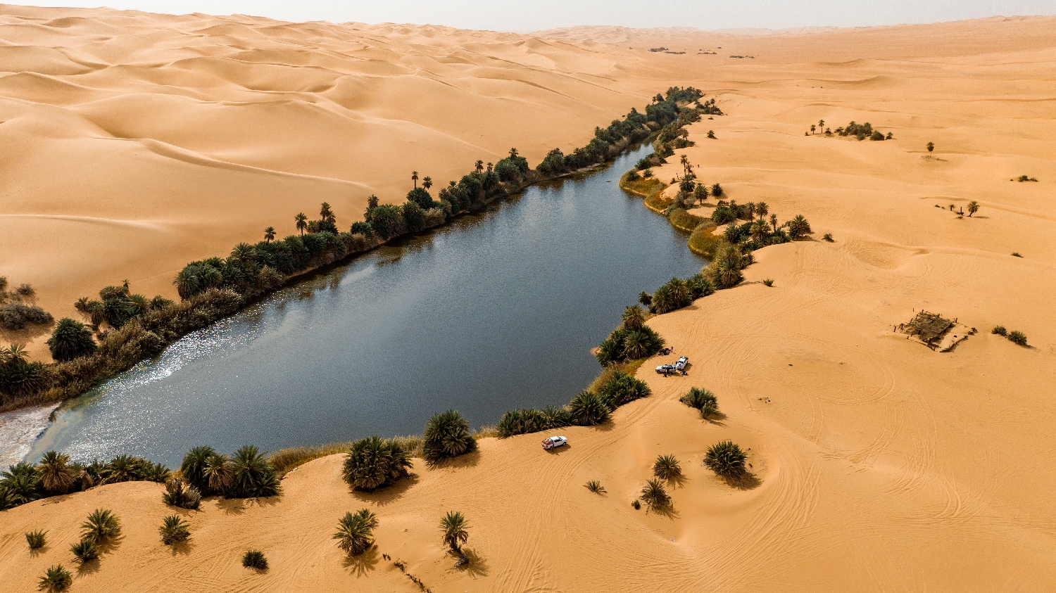
Hidden amidst the towering, rust-colored sand dunes of the Idehan Ubari sand sea in southwestern Libya, the Ubari Lakes, which include famous basins such as Gabron and Umm al-Ma, form a breathtaking chain of desert oases. Surrounded by towering dunes and date palms, these hyper-saline lakes shimmer like turquoise jewels against the harsh yellow and red desert backdrop. Historically, these palm-fringed waters sustained nomadic Berber communities and served as vital stops along ancient trans-Saharan caravan routes. Today, despite their extreme high salt content, which allows visitors to float effortlessly, the water remains remarkably cool and life-sustaining, contrasting sharply with the scorching surrounding desert temperatures.
GALLERY
EXPEDITION DOSSIER



PHOTOGRAPHER ID
CLASSIFIED